| Explorer
Map Index
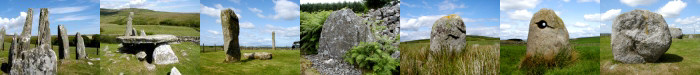
Stones visited in the Dumfries & Galloway region,
listed by Ordnance Survey 1:25,000 Explorer map coverage.
Click here Ordnance Survey
Landranger 1:50,000 Series.
|
Explorer 310
|
|
009 Caves of Kilhern, New
Luce.
|
Explorer 311
|
|
010 Drumtroddan Standing
Stones, Monreith. |
|
012 Hole Stone, Crouse,
Wigtown. |
|
013 Stone, Whithorn Priory,
Whithorn. |
|
015 Stone Setting, Kirkmabreck, Creetown. |
|
016 Cairn, Kirkmabreck,
Creetown. |
|
017 Torhouse Stone Circle,
Wigtown. |
|
018 Standing Stones,
Torhouskie, Wigtown. |
Explorer 312
|
|
007 Cairnholy I, Kirkdale,
Creetown. |
|
008 Cairnholy II, Kirkdale,
Creetown. |
|
011 Glenquicken Stone Circle,
Creetown.
|
Explorer 313
|
|
020 Twelve Apostles Stone
Circle, Dumfries
|
Explorer 319 |
|
014 Chambered Cairn, Boreland,
Newton
Stewart. |
Explorer 323
|
|
003 Girdlestanes,
Eskdalemuir. |
|
004 Loupin' Stanes, Eskdalemuir. |
|
005 Stone, Loupin'
Stanes, Eskdalemuir. |
|
006 Whitecastles Stone Circle,
Langholm. |
Explorer 330 |
|
019 Bannock Stane, Moffat. |
|
021 Standing Stones, Dyce,
Moffat |
Explorer 332
|
|
001 Standing Stone, Poldean,
Moffat. |
|
002 Standing Stone, Newton,
Moffat. |
|